Village Map
Drag the map below to explore the area. For a tour of the village, see our Virtual Tour page.
View Larger Map
The above map is from OpenStreetMap and you are free to use it in any publication subject to the terms of the Creative Commons Share Alike license.
Map & Directions
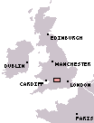
Stanford in the Vale is located in Oxfordshire, England, and is approximately 60 miles west of London. It is half way between Swindon and Oxford and lies on the A417 between Faringdon and Wantage.
 |
 |
From the West and South West (M4)
Leave the M4 at junction 15 and travel north up the A419 until you see an exit for the A420 (Oxford). Just after you pass Faringdon, you'll reach the Stanford Road Roundabout - turn right, signposted Stanford in the Vale.
From the East and South East (M4)
Leave the M4 at junction 13 and travel north up the A34 until you see the exit signposted Wantage. Take this exit, and follow the A417 through Wantage town centre, following signs for Challow. After leaving Wantage, continue on the A417 and after aproximately 6 miles you will arrive at Stanford.
From the North (M40 / A34)
Leave the M40 at junction 9 and travel south down the A34 (signposted Oxford). Leave the A34 at the Botley Interchange, take the third exit signposted A420 (Swindon). Shortly after the roundabout at Kingston Bagpuise (approx. 10 miles from Oxford), take the left turn signposted Stanford in the Vale.
Google Route Finder